Convenience and Speed with GRASS GIS 8.0 and 8.2
NCSU GeoForAll Lab
at the
Center for Geospatial Analytics
NC State University
May 26, 2022
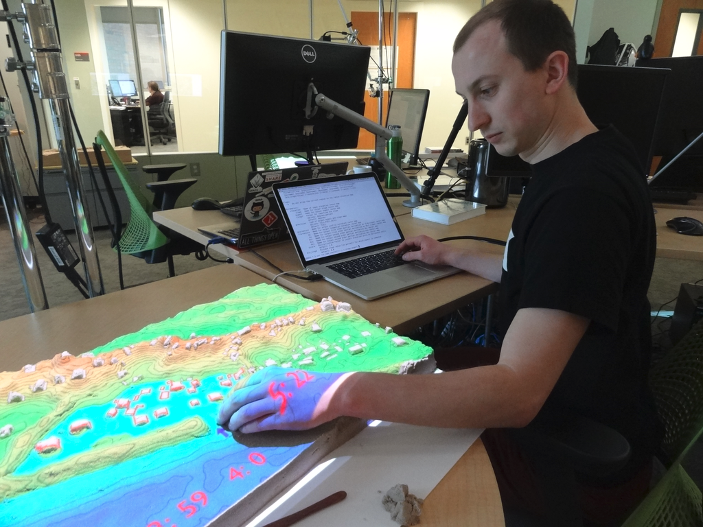
Vaclav (Vashek) Petras
- Geospatial Research Software Engineer at NC State
- BS & MS in Geoinformatics, Czech Technical University in Prague, Czechia
- PhD in Geospatial Analytics, NC State
- GRASS GIS: Development Team, Project Steering Committee
- OSGeo: Charter Member
Community
-
Open community of users and contributors
- Affiliations: industry, academia, government
- Contributions: code, documentation, free support, …
-
Project Steering Committee
- PSC Chair: Verónica Andreo (since February 2021)
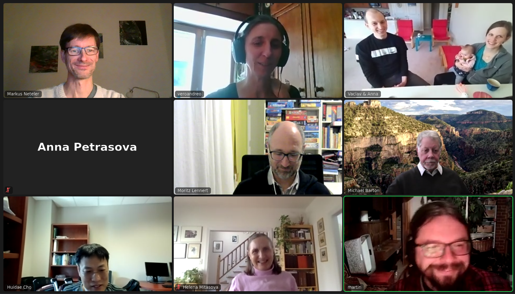
Credit goes to the whole community, not just this talk's author.
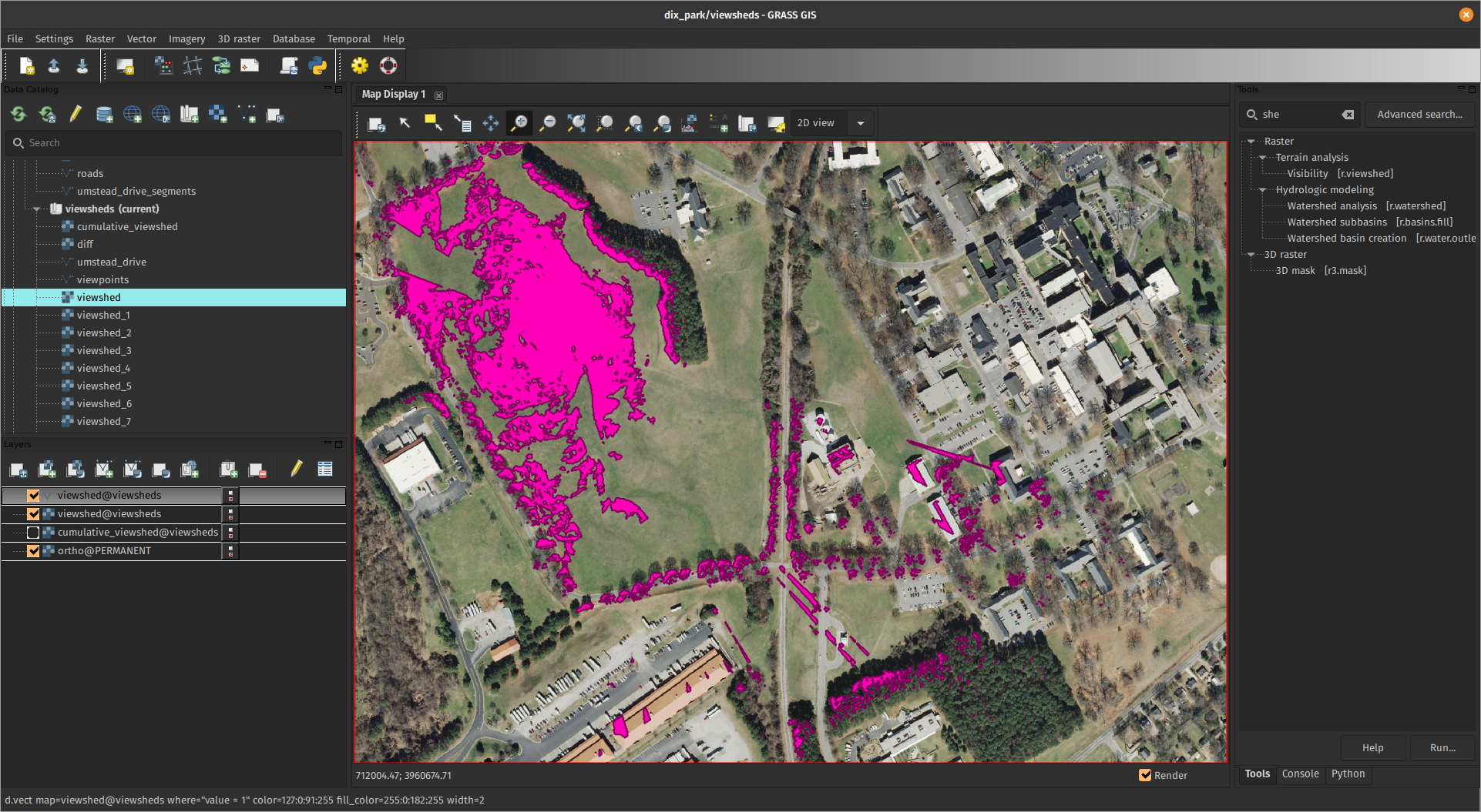
General Features
- Open-source and directly user-driven development
- Processing tools: 400+ in core, 400+ addons
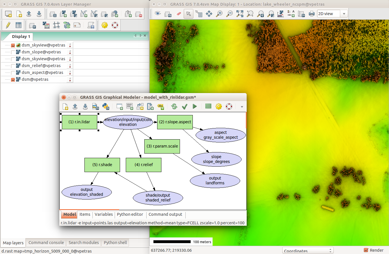
- Interfaces: graphical, command line, Python, C
- 3rd party interfaces: actinia (REST API), R, QGIS, OGC WPS
- Innovation with Stability & All-in-one Software Suite
Long-term Benefits
-
Individuals:
- Emphasis on backwards compatibility.
- Old commands, often work in new versions with minimal changes.
- Employer-independent.
- Learn once, use forever.
-
Organizations:
- No usage license fees.
- Provider-independent, contractor-independent.
- Financial investments go to a public pool.
Roadmap
- 7.8.7, Feb 23, 2022 Stability and fixes.
- 8.0.0, Feb 21, 2022 New startup, data management.
- 8.0.2, May 12, 2022 Stability and fixes.
- 8.2.0 Release Candidate 2, May 24, 2022 Available for testing.
- 8.2.0, June 2022 Jupyter, parallel r.neighbors, …
major.minor.micro – micro (x.y.z) brings fixes, minor (x.y) brings features, major (x) brings features and possibly backward incompatible changes

Questions?
Convenience Improvements
First-time User Experience
Initial project sets up automatically and suggestions for next steps are provided.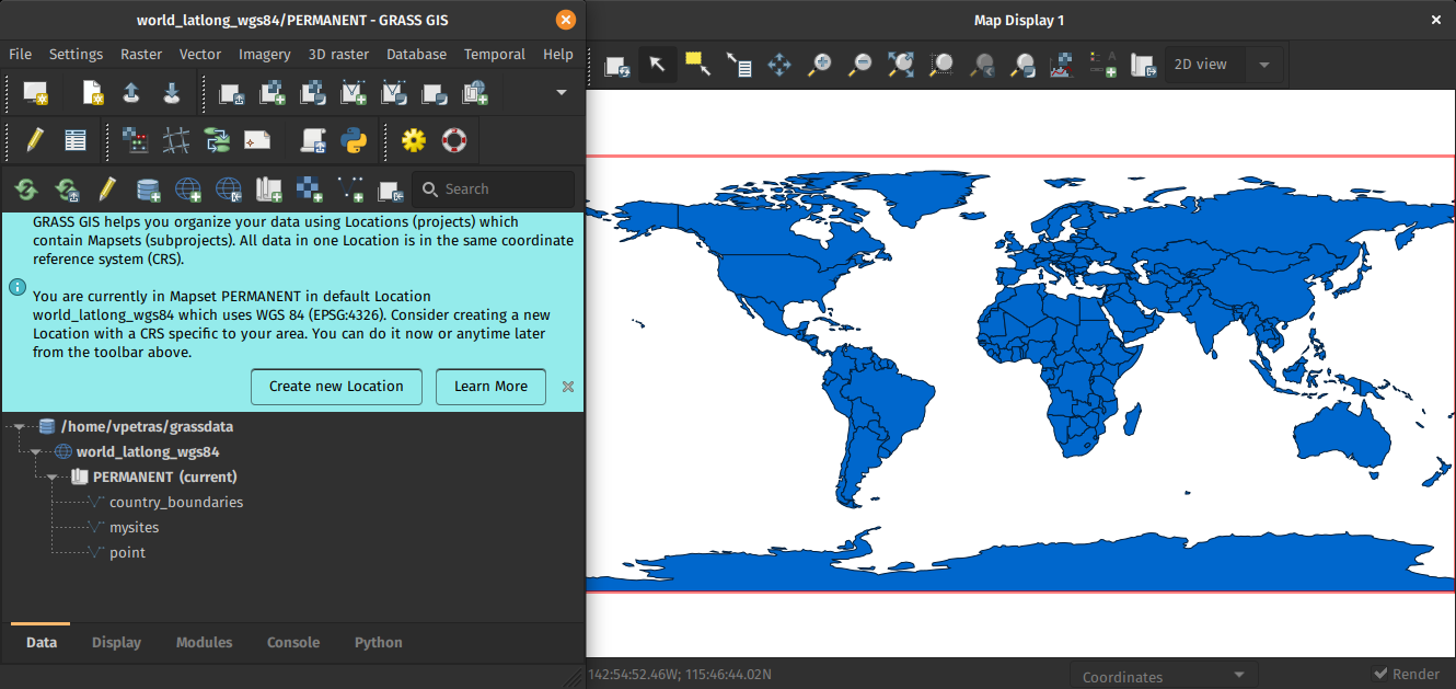
by Linda Kladivova & rest of the community (many reviews, video calls, user surveys, …)
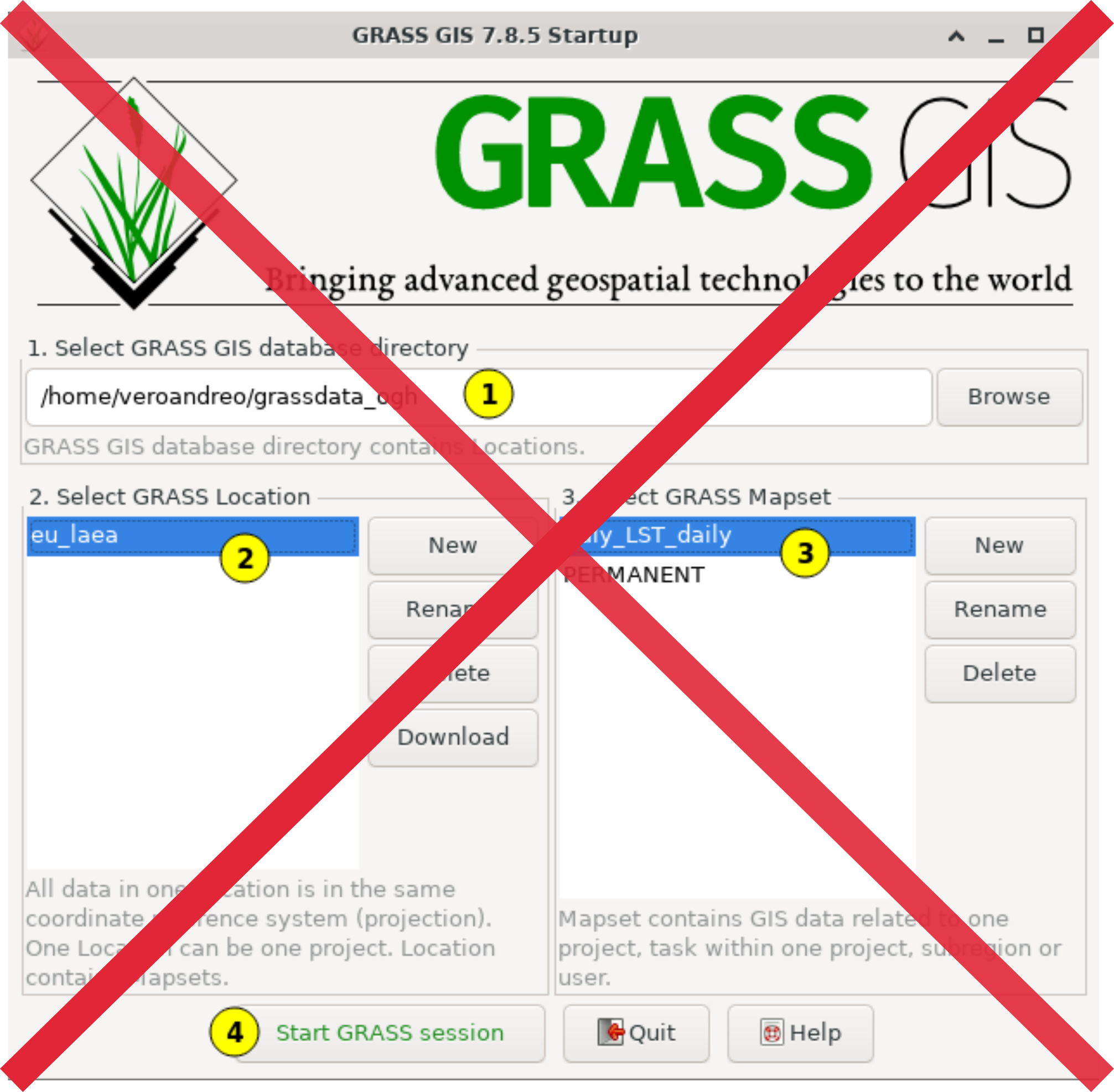
No Startup Screen
Centralized Data Management
All data manipulation centered around revamped Data tab.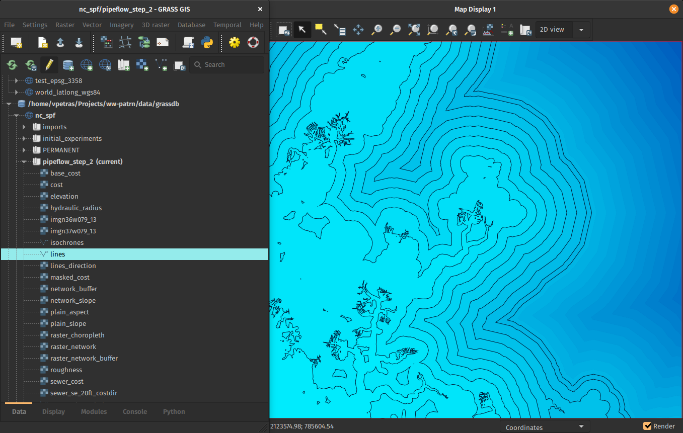
by Linda Kladivova, Anna Petrasova, Vaclav Petras
Single-Window GUI
One window with optimized layout.
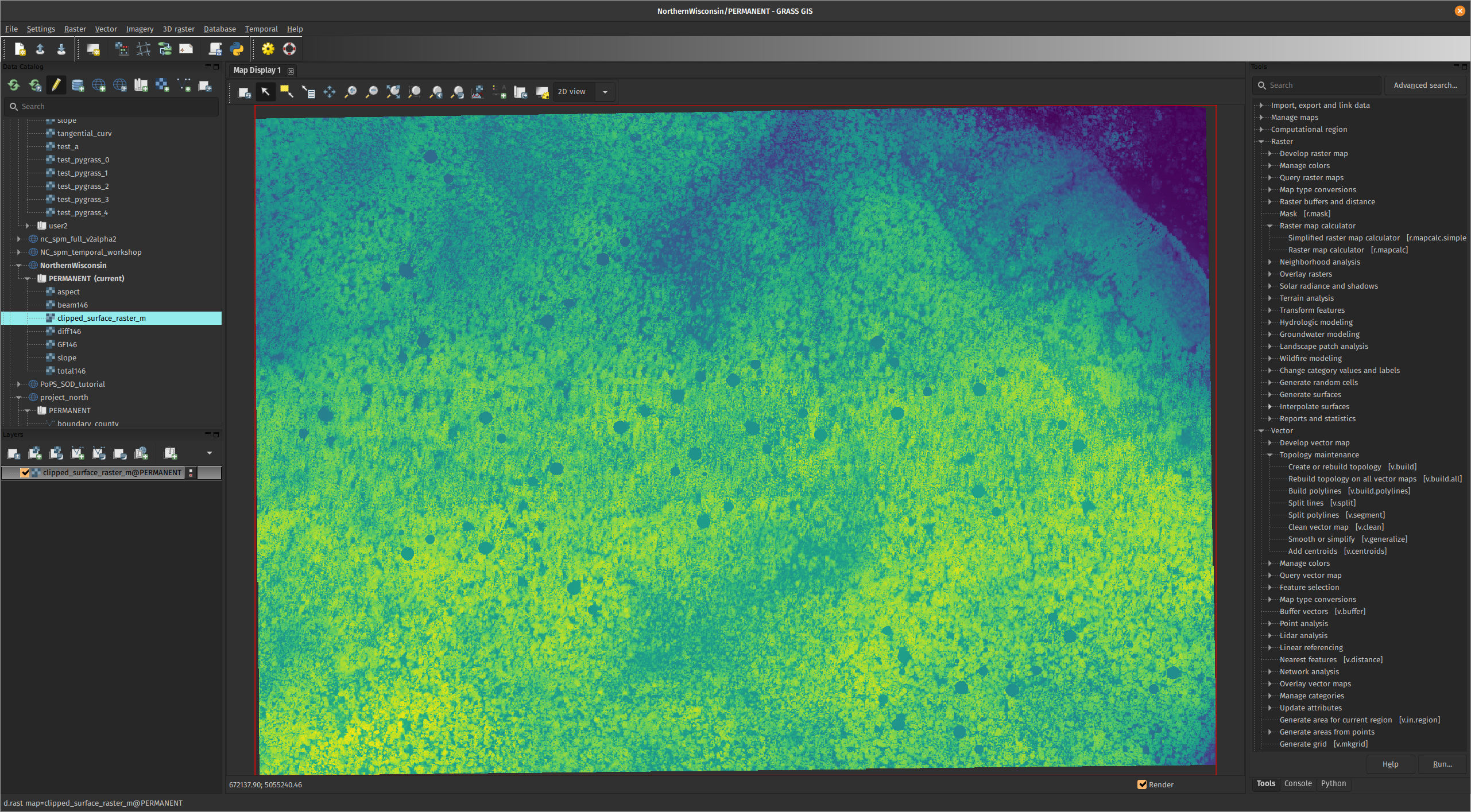
Opt-in preview in 8.2: Settings > Preferences > General
by Linda Kladivova
Integration with Jupyter Notebooks
- Notebooks: Mix of text, code, results, images, …
- Usage: Prototyping, reproducibility, tutorials, …
- Now in GRASS GIS: Python functions for easy integration
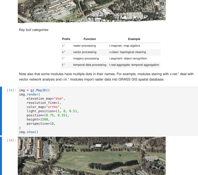
by Caitlin Haedrich
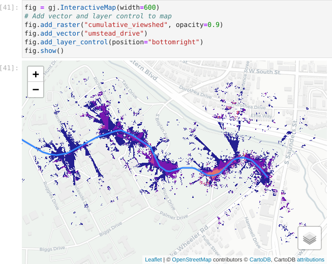
Integration with Jupyter Notebooks
Web map with base maps, zooming, customizations, …
Integration with Jupyter Notebooks
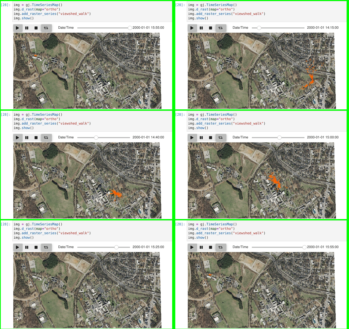
Time-series visualization
Integration with Jupyter Notebooks
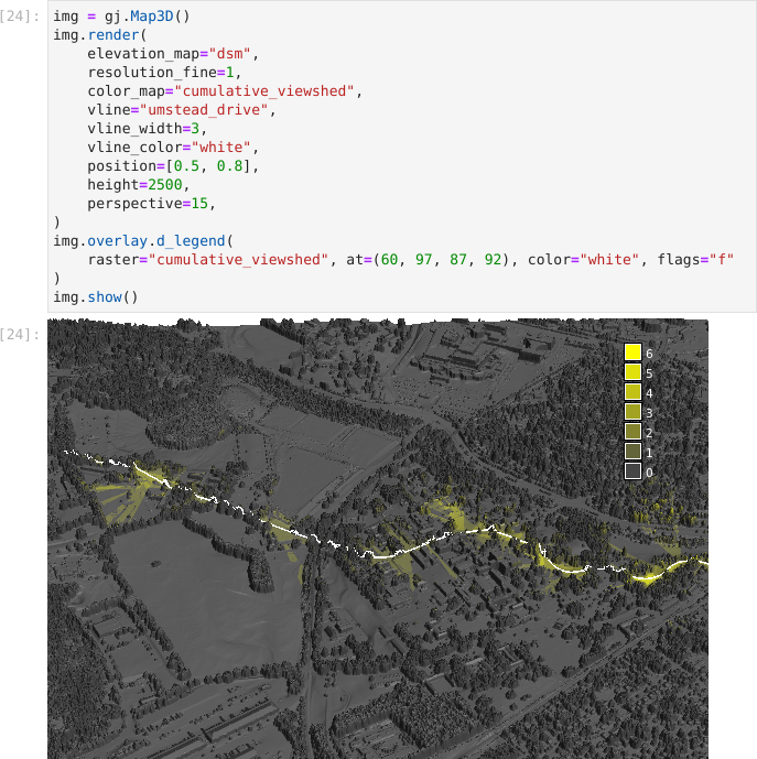
3D visualization
Semantic Labels for Rasters
-
attach a labels to raster maps
(e.g.,
S2_1orred)- image classification can use sematic labels to identify bands
- different scenes can then be classified if semantic labels are the same
- organize bands within one spatio-temporal dataset
by Maris Nartiss, Martin Landa, Markus Metz
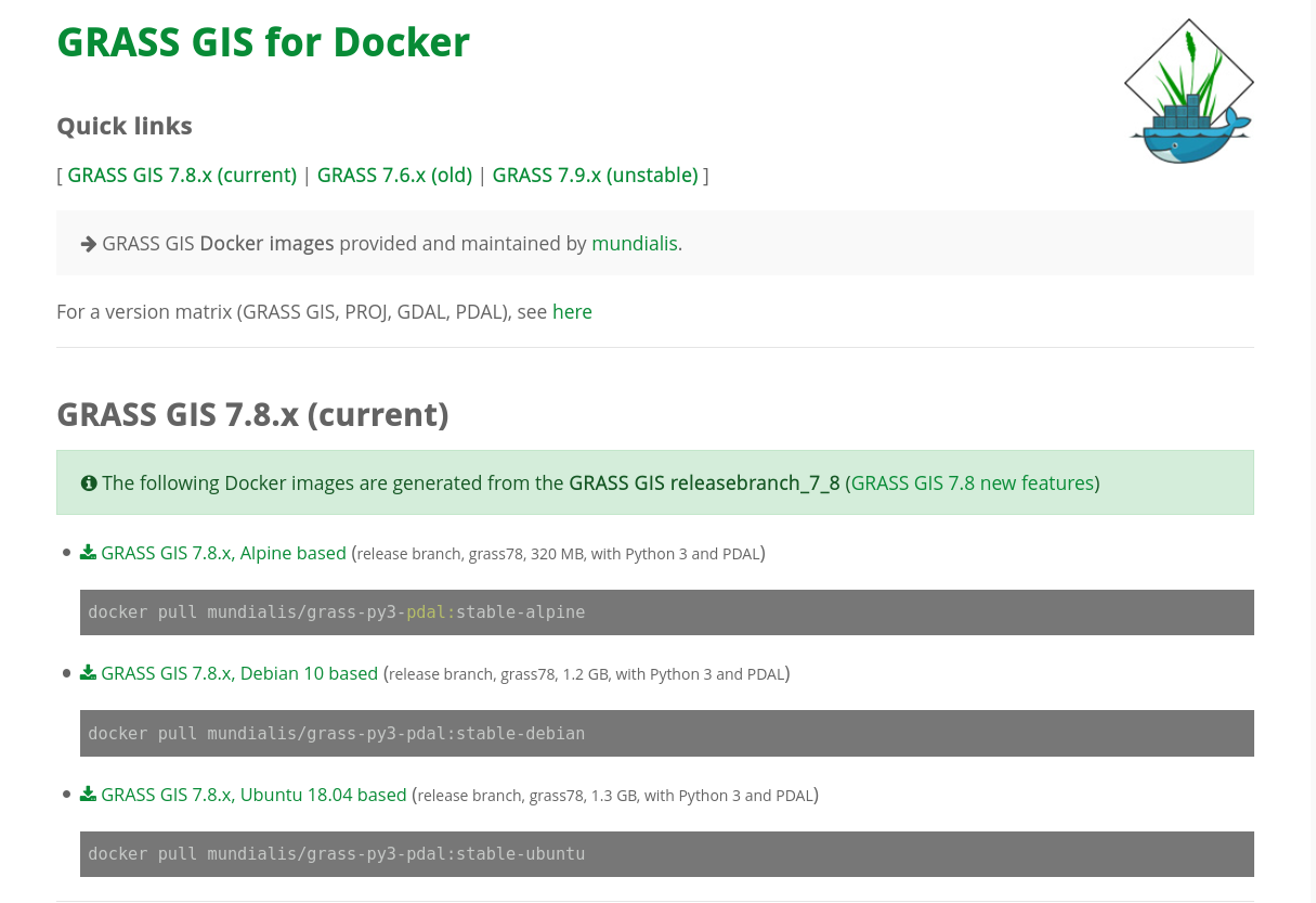
Docker Containers
- Different flavours
- Built and updated automatically
- For all branches and tags
actinia
- REST API
- 3rd party project, open source
- github.com/mundialis/actinia_core
Questions?
Speed Improvements
Multi-threading with OpenMP
- More tasks done in parallel in the same tool
nprocsspecifies number of cores (processes, threads)memoryspecifies RAM in MB- Performance section in documentation describes the behavior

r.series (OpenMP parallel)
Cell value is a function of the corresponding cells in the inputs.

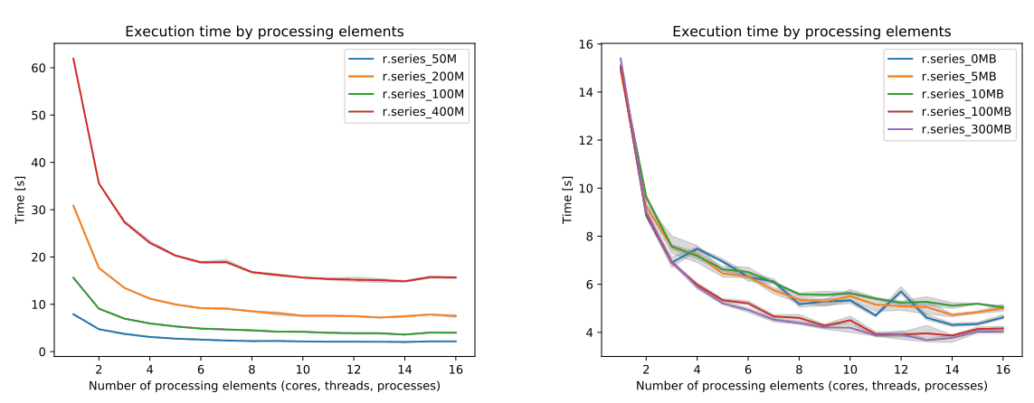
by Aaron Saw Min Sern in 8.2
r.neighbors (OpenMP parallel)
Cell value is a function of the cells around it.
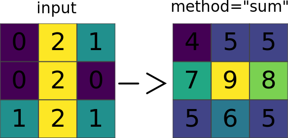
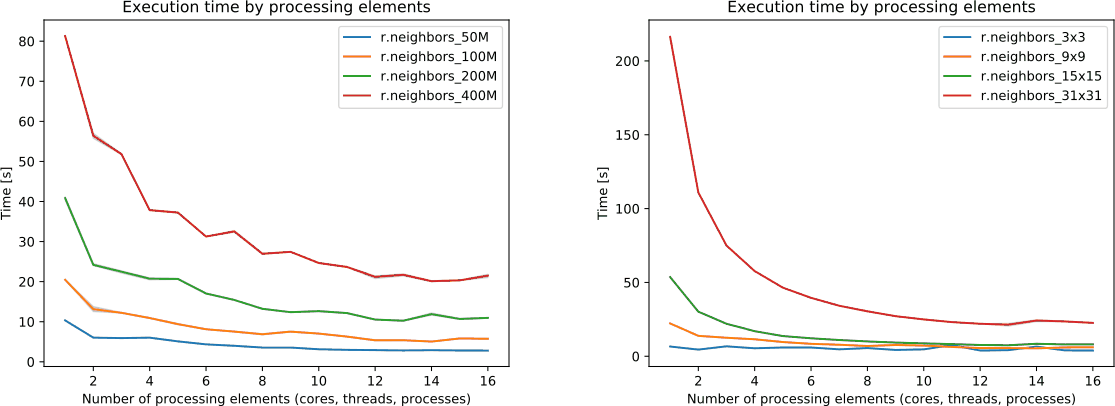
by Aaron Saw Min Sern in 8.2
r.mfilter (OpenMP parallel)
Cell value is a function of the cells around it.

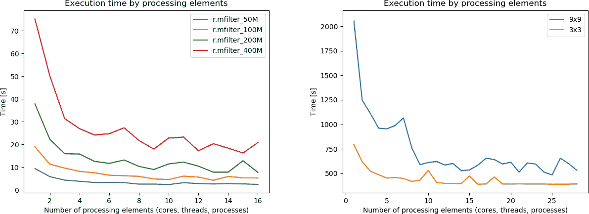
by Aaron Saw Min Sern in 8.2
r.slope.aspect (OpenMP parallel)
Slope, aspect, and other derivatives of an elevation raster.

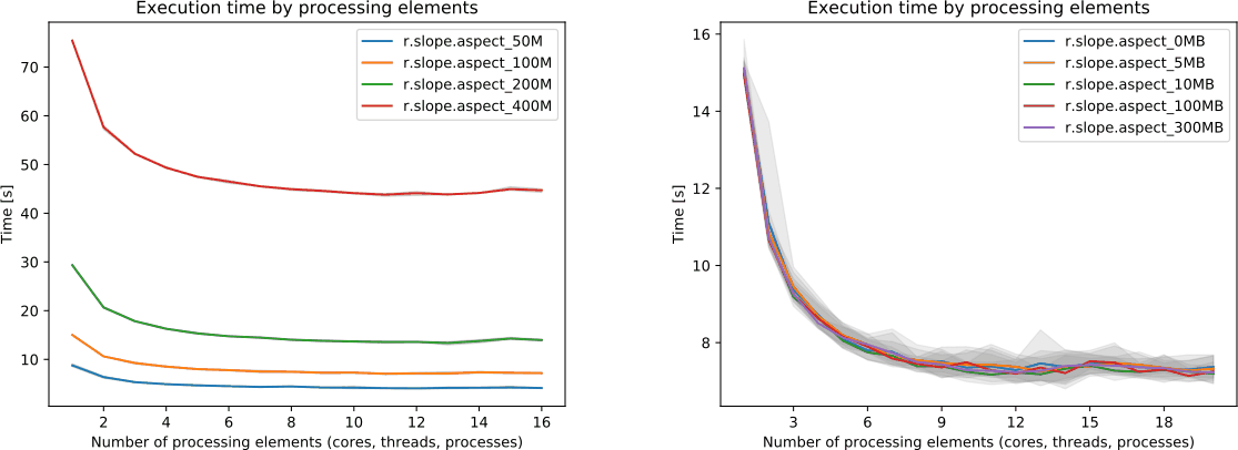
by Aaron Saw Min Sern in 8.2
r.patch (OpenMP parallel)
Mosaic multiple rasters into one.

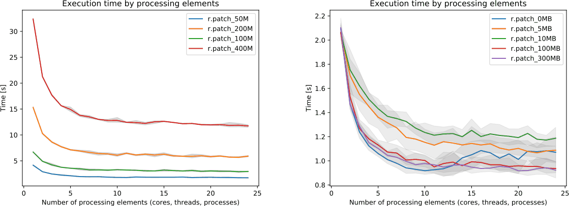
by Aaron Saw Min Sern in 8.2
More parallel tools
- Core tools: r.sun, v.surf.rst, r.sim.sediment, r.sim.water
- Addons tools: r.sun.daily, r.in.usgs, r.mapcalc.tiled, t.rast.what.aggr, r.connectivity.corridors, r.viewshed.exposure, and 14 more
-
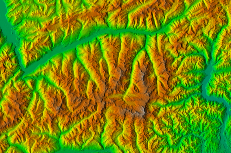
Parallelizing custom Python scripts:
- GridModule (by tile)
- multiprocessing, ParallelModuleQueue (by task)
Faster External Data Links
-
r.external can link (open) external raster data faster.
- 2-5× faster computation of min & max
- almost no time if min & max in metadata
- almost no time if min & max are not needed later
- Great for workflows when only portion of the data is processed in GRASS GIS.
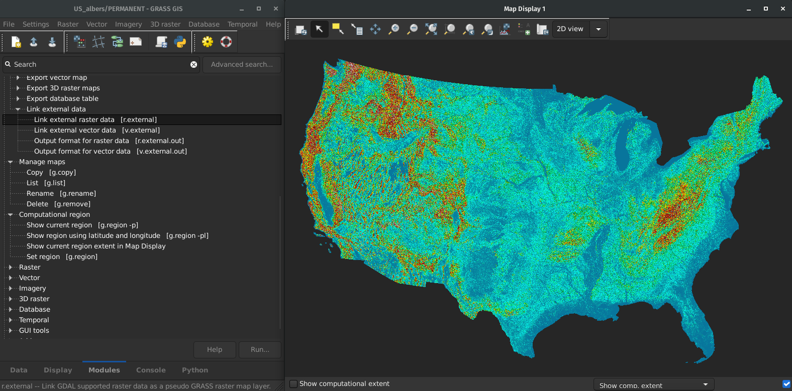
by Markus Metz
Improved HPC Readiness
- Recipes for High Performance Computing setups
- Better integration with conda environments
- Reduced potential for race conditions
- Easier to create parallel workflows
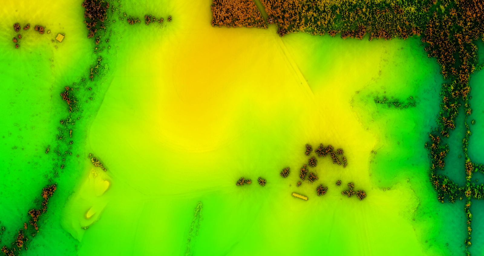 by Vaclav Petras, Markus Neteler, Nicklas Larsson, …
Questions?
More Features
Science and Code
-
What algorithm
- references to related scientific papers
- references to papers associated with tools or libraries
-
What exact code
- source code, its history, and latest change
-
DOI record with a copy of the code for each release
- One to cite all versions: DOI: 10.5281/zenodo.5176030
- One for each released version
→ transparency, reproducibility, provenance
-
How used
- usage visible in scientific literature
- GRASS GIS Google Scholar profile, h-index 93 (experimental)
Lidar Data Import with PDAL
- Binning & filtering using any point dimension (including user defined ones, e.g., from PDAL filters)
- Support for 19 binning methods
- Linux and macOS only. Help needed for Windows!

by Vaclav Petras and Maris Nartiss
Skeletons and Centerlines
v.voronoi tool can now create area skeletons and centerlines.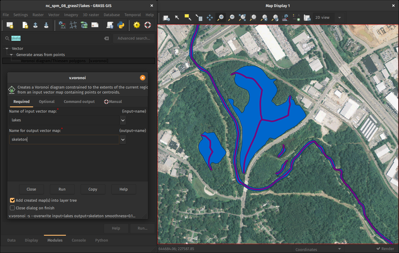
by Markus Metz
GitHub-centered Software Development
- Git
- PRs
- Issues
- GitHub Actions

Improved and Robust Code Quality Checks
- Python code formatted by Black.
- Python code checked against Flake8, some even Pylint.
- Most of warnings in C code removed and now checked.
- Code tested with CodeQL.
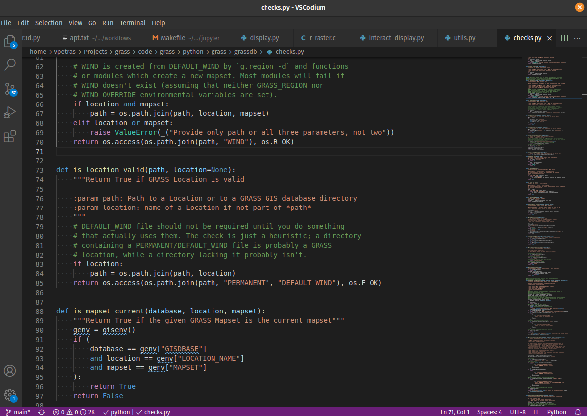
by Nicklas Larsson, Vaclav Petras, Anna Petrasova, Carmen Tawalika, ...
Addons Repository
- Community-maintained tools (addons aka extensions, plugins)
- Separate from the main repository, but only one repository
- A repository with the source code, not just a registry
- Best of both worlds:
- Broader community of contributors, including one-time contributors
- Single repository maintained by the core community

Questions?
FUTURES
r.futures - set of tools for urban growth modeling
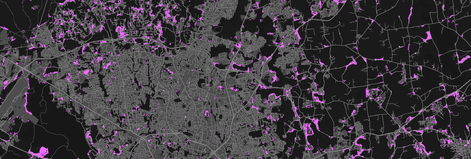
by NC State Center for Geospatial Analytics
PoPS
r.pops.spread - Pest or Pathogen Spread simulation
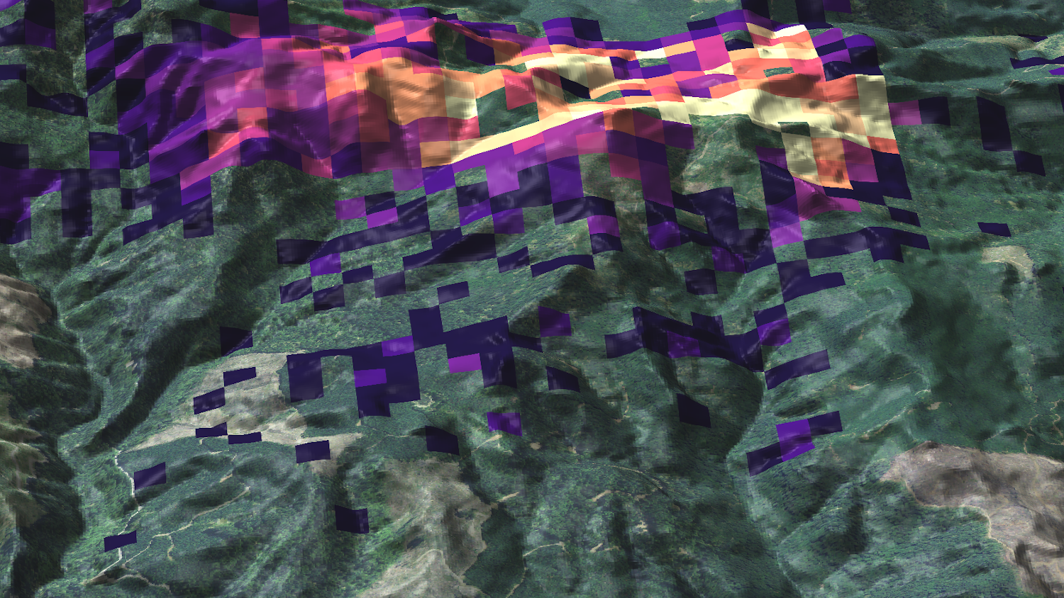
by NC State Center for Geospatial Analytics
Visual Exposure to a Defined Source
r.viewshed.exposure - Weighted cumulative viewshed analysis defining visual exposure to a source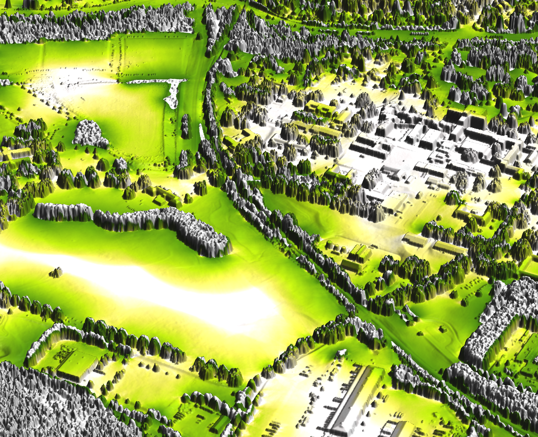
by Zofie Cimburova and Stefan Blumentrath
Weighted Layers for Dasymetric Mapping
r.area.createweight - Weighting layer for dasymetric mapping using a random forest regression model.
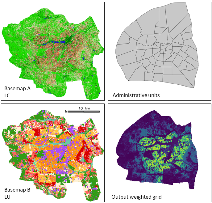
by Charlotte Flasse, Tais Grippa, Safa Fennia
Hydrologic Parameters Using a Flow Direction Raster
r.accumulate - Weighted flow accumulation, subwatersheds, stream networks, and longest flow paths using a flow direction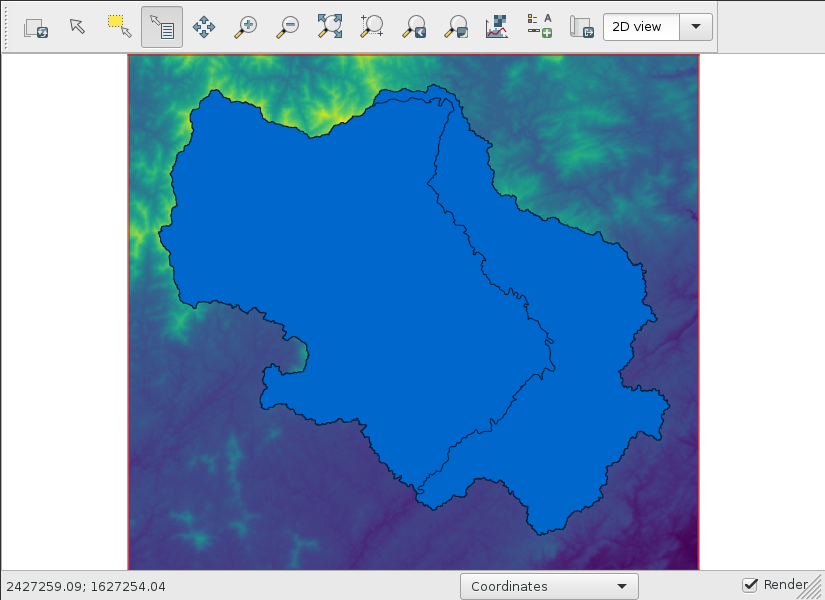
Cho (2020): A recursive algorithm for calculating the longest flow path and its iterative implementation
(faster and better than competition)
See also: Physically-based hydrologic modeling using GRASS GIS r.topmodel
by Huidae Cho
Valley Bottom Flatness Index
r.valley.bottom - Multi-resolution Valley Bottom Flatness (MrVBF)
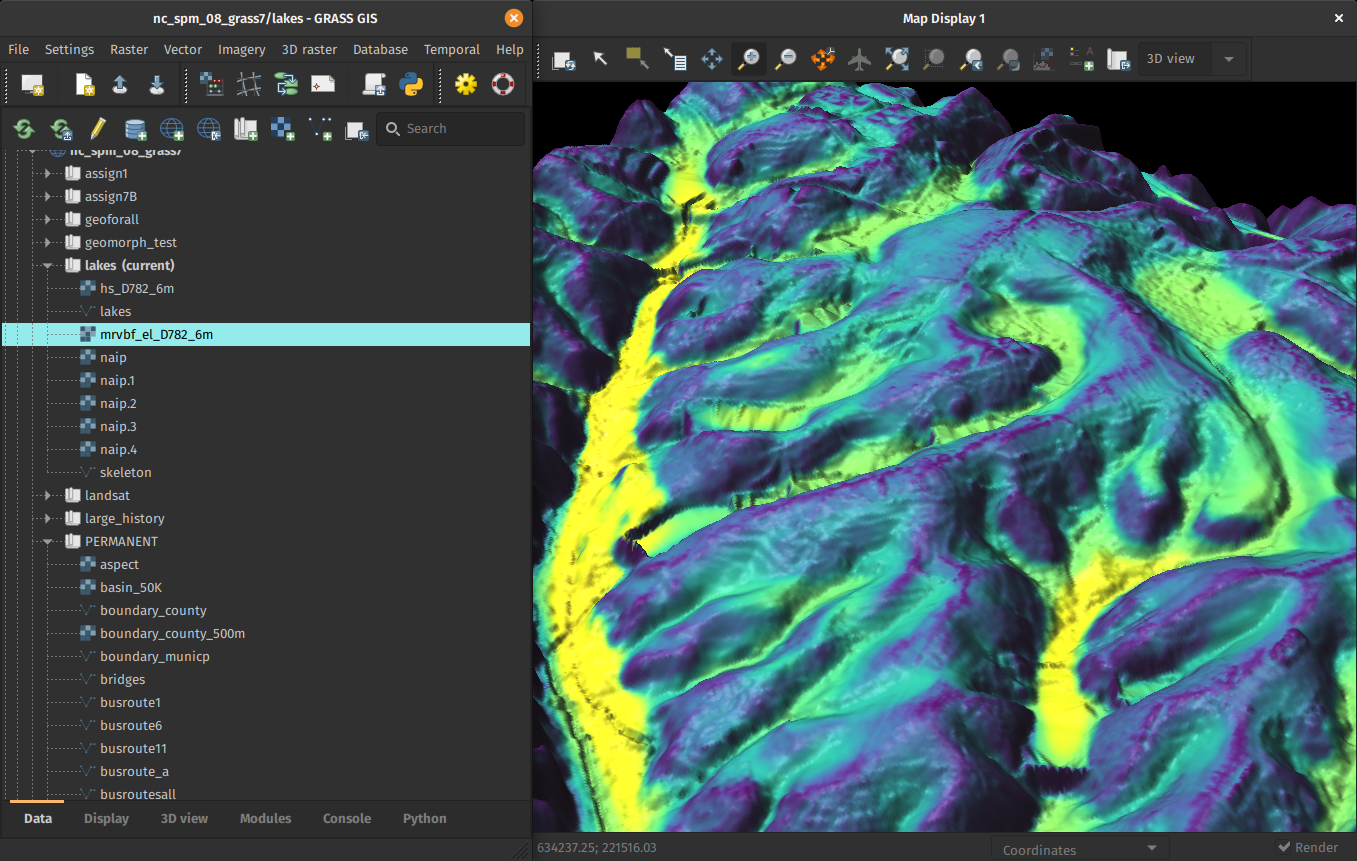
by Helmut Kudrnovsky, Steven Pawley
Sentinel, THREDDS, …, netCDF, CSV
Automated download and import of common datasets i.sentinel, i.modis, i.landsat, r.in.usgs, r.in.nasadem, m.crawl.thredds, t.rast.import.netcdf, …
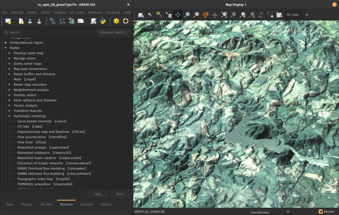
by Fondazione Edmund Mach, OpenGeoLabs, mundialis GSoC, NC State University, CONICET, Norwegian Institute for Nature Research, …
Resources
- Documentation:
- Tutorials (my three favorites):
-
Books:
- Open Source GIS: A GRASS GIS Approach (the classic)
- Tangible Modeling with Open Source GIS (use-case-based with additional flavors)
- Open Source Approaches to Spatial Data Handling (broader context)
Support
- Community support
- user mailing list (with vast archives since 1991)
- GIS StackExchange (use increasing)
- GitHub Discussions (since September 2021)
- Commercial support
Sponsoring
- Individuals:
- Time: organize virtual community event, fix typos, …
- Money: opencollective.com/grass (new!)
- Organizations:
- Time: employee time
- Money: pay developers (companies) to add features or fix bugs
vpetras@ncsu.edu
Twitter: vaclavpetras
LinkedIn: Vaclav Petras