Tips and Tricks for GRASS GIS 8.2
NCSU GeoForAll Lab
at the
Center for Geospatial Analytics
NC State University

NCGIS, March 8-10, 2023
Vaclav (Vashek) Petras
- Geospatial Research Software Engineer at NC State's Center for Geospatial Analytics
- BS & MS in Geoinformatics, Czech Technical University in Prague, Czechia, PhD in Geospatial Analytics, NC State
- GRASS GIS: Development Team, Project Steering Committee
- OSGeo: Charter Member
Pick Your Version of GRASS GIS
- 7.8.8 Legacy, Spring 2023 Maintained legacy version
- 8.2.1 Current, January 2023 Current version
- 8.3.0 Preview, Daily Latest reviewed functional code
major.minor.micro – micro (x.y.z) brings fixes, minor (x.y) brings features, major (x) brings features and possibly backward incompatible changes
Explore Both Core and Addons Tools
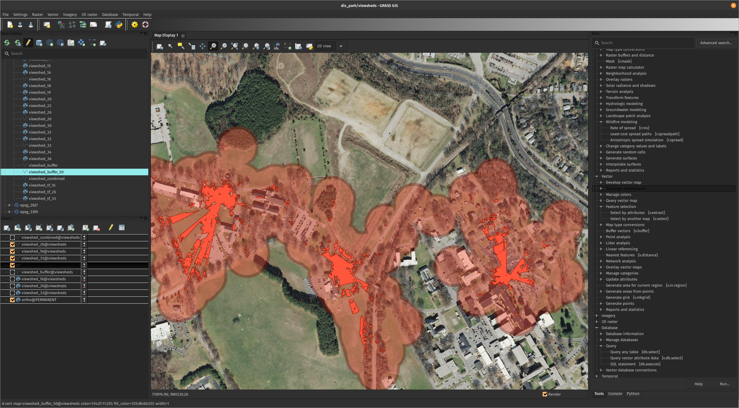
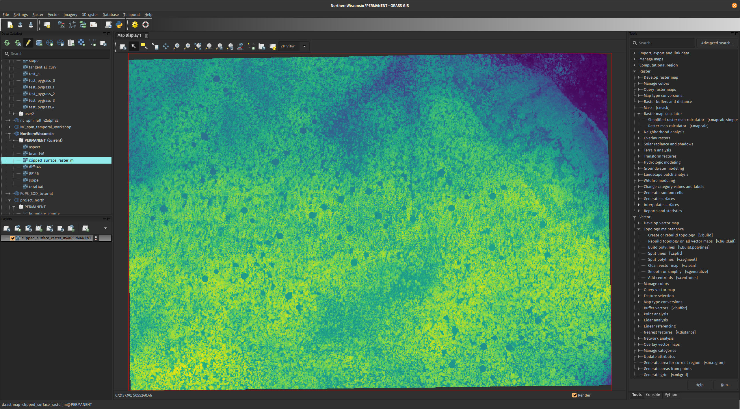
Use Data Management Panel
… and explore other panels.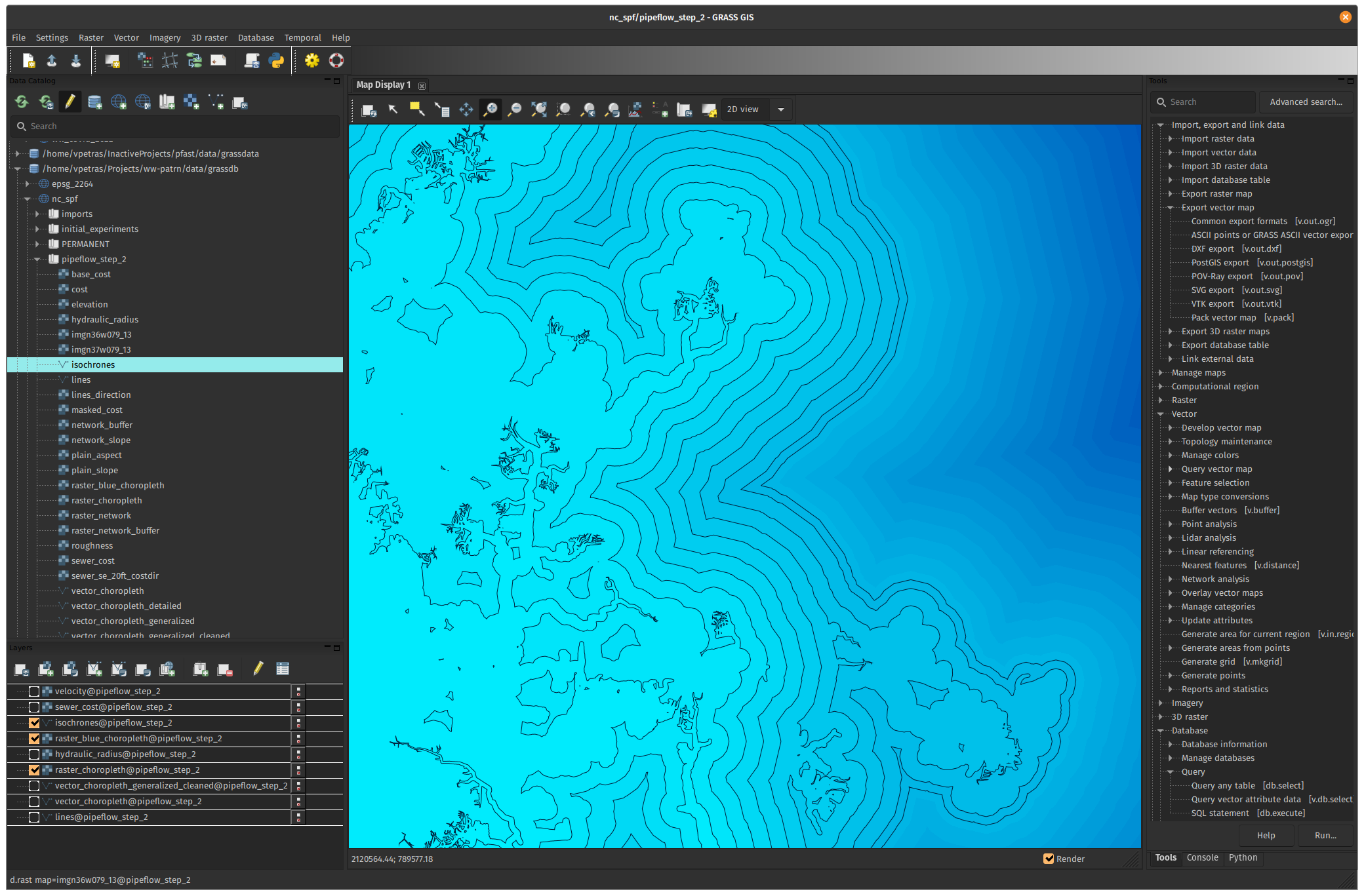
Switch to Single-Window Interface in 8.2
Settings > Preferences > General > Use single-window mode
Forget the Startup Screen
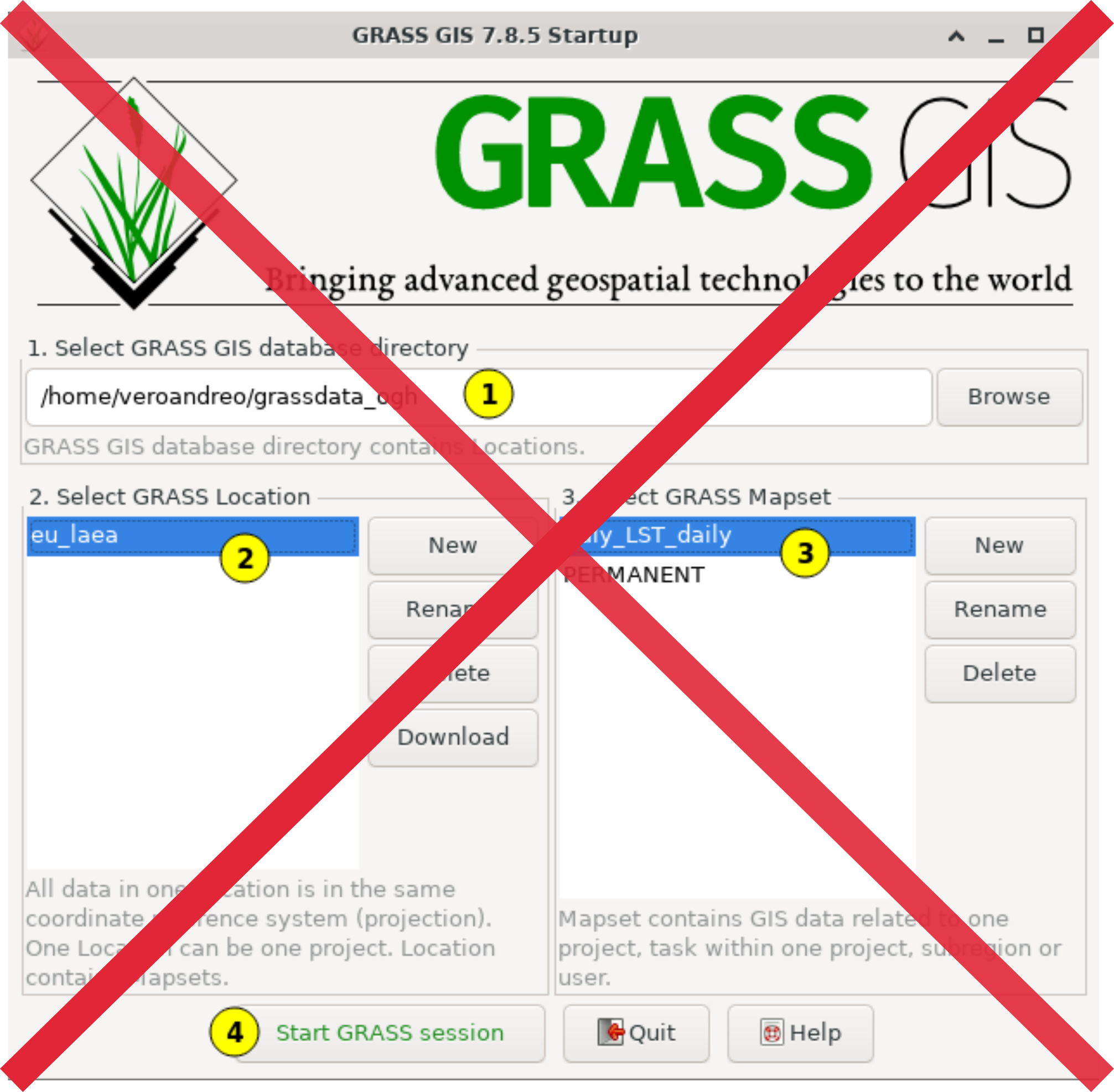
Follow Startup Tips
Initial project sets up automatically, but read the provided suggestions for next steps.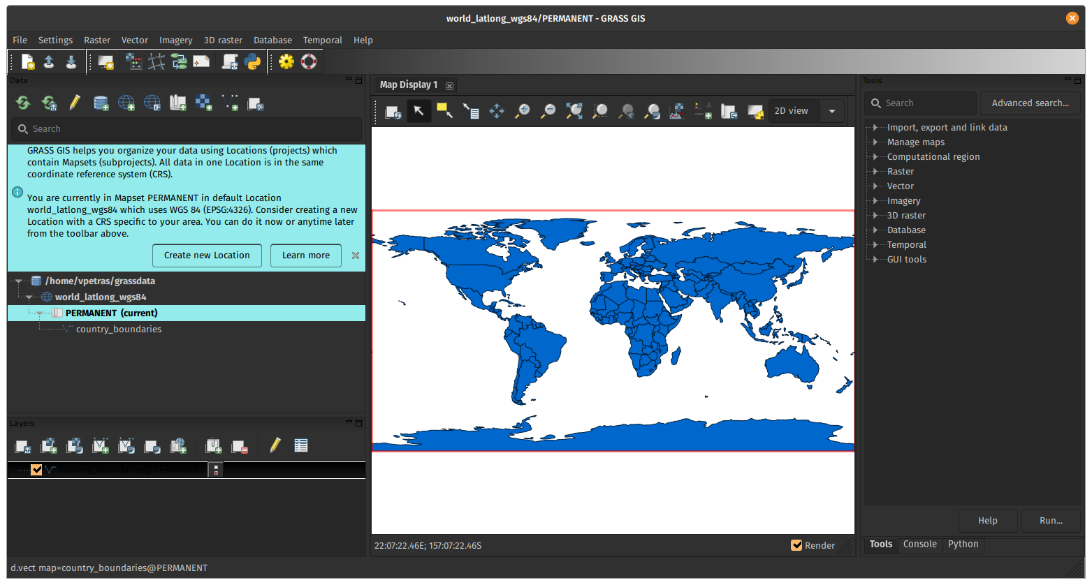
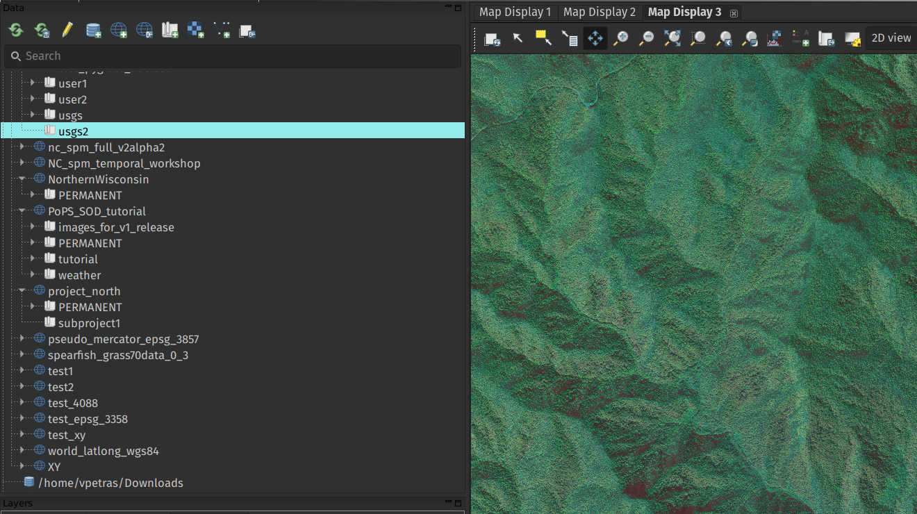
Use Mapsets to Organize Data
Use mapsets as subprojects to group related data.
- Only data in the current mapset can be modified.
- Data from other mapsets are accessible for reading.
Use Python to Automate Workflows
Automate both processing and visualization
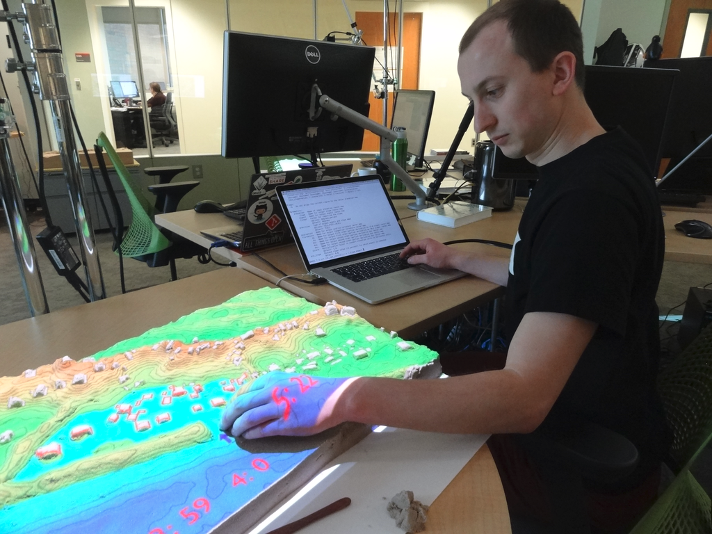
Use Jupyter Notebooks
- Mix text, code, results & images.
- Use for prototyping, reproducibility, or tutorials.
- See grass.jupyter for easy integration.
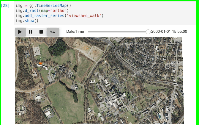
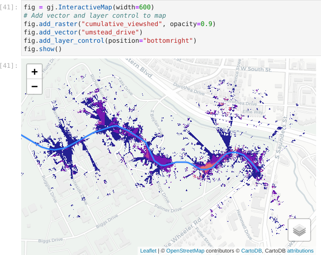
Generate Quick Web Maps
Use grass.jupyter to quickly generate interactive web maps.
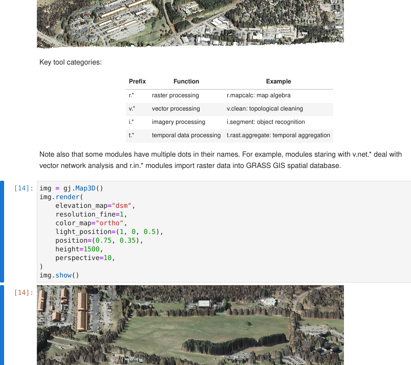
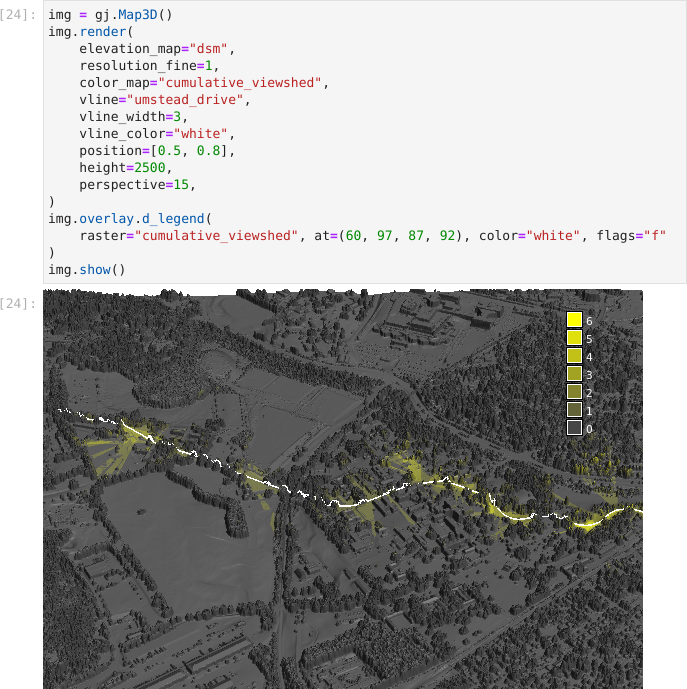
Automate 3D Visualizations in Python
Use grass.jupyter.Map3D to generate 3D visualizations.
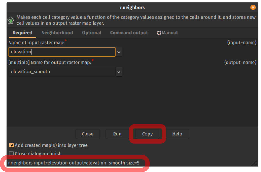
Check out the Command Line Interface
Underlying command is available at the bottom of the dialog.
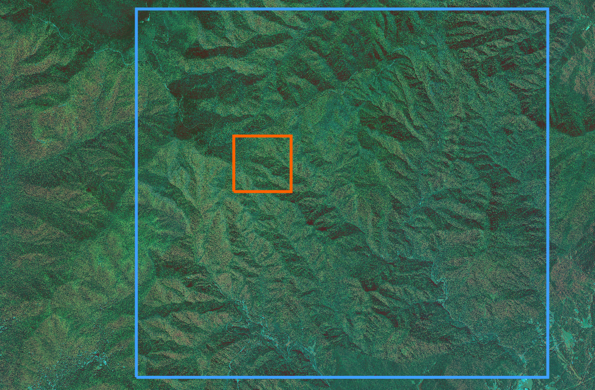
Use Smaller Region Extent for Tests
- Use smaller extent for computation region when testing.
- Switch to the full extent when you tested your workflow.
- Keep the resolution the same.
Align Your Grids
- Align computation region grid to:
- raster with Adjust cells to clearly align with...
- multiples of given resolution value with Align to resolution

Attach Semantic Labels to Rasters
-
image classification can use sematic labels to identify bands
- different scenes can then be classified if semantic labels are the same
-
organize bands within one spatio-temporal dataset
- each band can be referred to separately
- example labels:
red,blue,S2_1
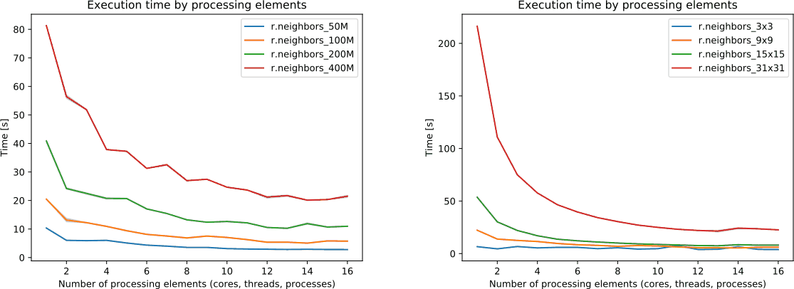
See the Tool's Performance Parameters
nprocsspecifies number of cores (processes, threads).memoryspecifies RAM in MB.- You can always run more multiple tools in the background.
Read the Performance Documentation
The Performance section in tool's documentation describes its
- memory consumption
- parallel efficiency
- disk usage
in relation to different combinations of parameters.
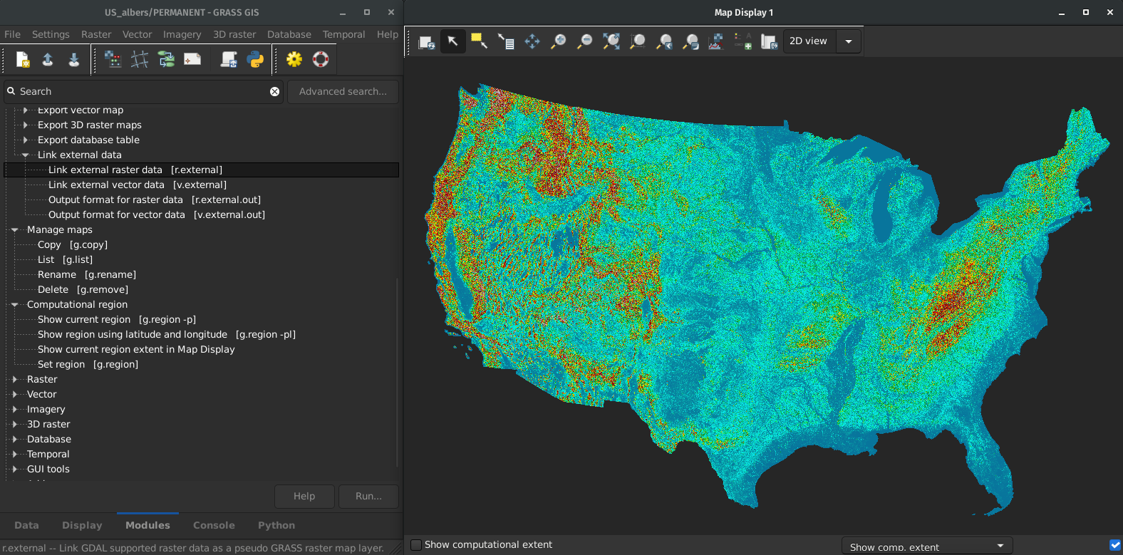
Link Data Instead of Importing
-
r.external can link (open) external raster data faster.
- almost no time if min & max in metadata or not needed later
-
v.external can link (open) external raster data faster.
- directly connects to PostGIS and understands its topology
- Great for workflows when only portion of the data is processed in GRASS GIS.
Don't Limit Yourself to Desktop
- small VM, Raspberry Pi, old laptop
- Docker
- HPC Clusters
- actinia
- OpenPlains
Check for Dataset-Specific Imports
GDAL can do a lot just by itself, but i.sentinel, i.modis, i.landsat, r.in.usgs, r.in.nasadem, m.crawl.thredds, t.rast.import.netcdf, … make things much more convenient.
Get Support When Needed
- Community support
- Gitter chatroom (since 2022)
- user mailing list (with archive since 1991)
- GIS StackExchange
- GitHub Discussions
- Commercial support
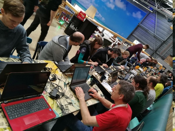
Get Things Done (Individuals)
- Time: organize a [virtual] community event, check grammar
-
Money: opencollective.com/grass
- Single-Window Interface, Visualizations for Notebooks
Get Things Done (Organizations)
- Time: employee time
-
Money: pay developers/companies
-
Provider-independent, contractor-independent
- If you don't like us, you can hire someone completely independent.
- Financial investments go to a public pool
-
Provider-independent, contractor-independent
Lifetime license for current users in the audience and for everyone who asks a question.*
vpetras@ncsu.edu,
@vaclavpetras, @wenzeslaus
wenzeslaus.github.io/grass-gis-talks
*The GNU General Public License version 2.0 or higher terms and conditions apply.