Education
-
GIS/MEA582: Geospatial Analysis and Modeling
For a class project, I was following the topic of wildfire spread modeling.
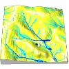
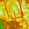
The course explains digital representation and analysis of geospatial phenomena and provides foundations in methods and algorithms used in GIS analysis. Special focus is on terrain modeling, geomorphometry, watershed analysis and introductory GIS-based modeling of landscape processes (water, sediment). The course includes analysis from lidar data, 3D visualization, and exploratory land management design with Tangible GIS. Assignments are performed in Open source GRASS GIS and ArcGIS.
-
MEA592: Multidimensional Geospatial Modeling
I created a web-based time series visualization tool as a part of my class project. I was leading a lecture focused on online data publication.
The course covers concepts, methods and tools for analysis and modeling of landscape dynamics using multitemporal georeferenced data and simulations. Representation of evolving phenomena using point clouds and particles, surfaces and voxel models will be explained. The course will also include hands-on practice and development of techniques for visualization and communication of lidar data time series and outputs of dynamic simulations using the state of the art technology in the GIST Visualization laboratory, such as 3D projection, immersion and tangible modeling system.
-

GIS505: Introduction to Geovisualization Technologies
Scientists, natural resource managers, and urban planners collect and visualize large, and often complex, geospatial data to analyze biophysical and social phenomenon and make informed decisions. New data acquisition and visualization technologies, which have numerous applications to both natural and social sciences, are developing rapidly. This course provides an overview of emerging methods and tools for the visual exploration, analysis, synthesis, and presentation of data that contains geographic information. Specific methods include the collection and representation of three-dimensional, remotely sensed, and gigapixel imagery. An introduction to the display of digital imagery and visualizations through interactive GIS and immersive virtual environment technology is also covered. The course is hands-on, providing an opportunity to interact with current technologies within the Center for Earth Observation’s Geovisualization Laboratory. Students will develop an understanding of how emerging digital imagery and visualization technologies can be utilized to enhance existing research methodologies and improve science communication.
-
GIS610: Geovisualization
Course development
-

Spatio-temporal data handling and visualization in GRASS GIS
First, we will introduce you to GRASS GIS 7, including its spatio-temporal capabilities and you will learn how to manage and analyze geospatial data time series. Then, we will explore new tools for visualization of spatio-temporal data. You will create both 2D and 3D dynamic visualizations directly in GRASS GIS 7. Additionally, we will explain the Space Time Cube concept using various applications based on raster and vector data time series. You will learn to manage and visualize data in space time cubes (voxel models). No prior knowledge of GRASS GIS is necessary, we will cover the basics needed for the workshop. This is a workshop created for FOSS4G 2014.
-
Introduction to GRASS GIS
Introduction to geospatial processing with GRASS GIS. The course covers basic control of the graphical user interface, invoking GRASS modules in different ways including scripting and various geospatial analysis.
-
GIS/MEA582: Geospatial Analysis and Modeling
I developed tools to create and maintain the course and its website.
The course explains digital representation and analysis of geospatial phenomena and provides foundations in methods and algorithms used in GIS analysis. Special focus is on terrain modeling, geomorphometry, watershed analysis and introductory GIS-based modeling of landscape processes (water, sediment). The course includes analysis from lidar data, 3D visualization, and exploratory land management design with Tangible GIS. Assignments are performed in Open source GRASS GIS and ArcGIS.