Software
Software I'm developing
-

GRASS GIS
GRASS GIS is a free and open source Geographic Information System (GIS) used for geospatial data management and analysis, image processing, spatial modeling, and visualization. GRASS GIS is all purpose GIS although it is focused mainly on scientific GIS applications involving big data. GRASS GIS is the Open Source Geospatial Foundation (OSGeo) project.
I contribute to the GRASS GIS project by developing new features and as a part of GRASS GIS community I support GRASS users personally or through mailing list and GIS StackExchange.
Feel free to contact me in case you have questions or you are interested in collaboration on some new features.
-

g.remote
g.remote is a module for GRASS GIS which can execute any module or script on a remote machine. It can copy the data to a temporary Location on the remote machine and copy the results back.
-
r.futures
r.futures is a group of modules in a GRASS GIS Addons repository which implements the FUTURES model developed by Meentemeyer et al. for modeling urban growth.
-
r.in.lidar
r.in.lidar is a GRASS GIS module which performs 2D binning of a lidar point cloud. I added functionality to help with performing tasks such as vegetation structure statistics.
-
r3.in.lidar
r3.in.lidar is a GRASS GIS module which performs 3D binning of a lidar point cloud to determine, e.g. vegetation structure. The module will be included in GRASS GIS 7.2.
-
r.ros, r.spread and r.fire.spread
r.ros and r.spread are GRASS GIS modules for simulating elliptical fire spread. I extended their inputs and outputs and used them in r.fire.spread module (available on GitHub) which can work with time-dependent inputs.
-
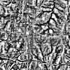
r.local.relief
r.local.relief is a GRASS GIS addon for creating a local relief model from elevation map. Usages include archeology and various terrain analysis tasks in general.
-
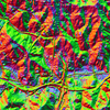
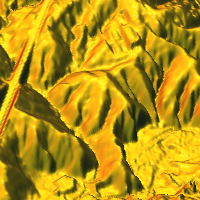
r.shaded.pca
r.shaded.pca is a GRASS GIS addon which creates relief shades from various directions and combines them into RGB composition. The combined shades highlight terrain features which wouldn't be visible using standard shading technique. This tool can be used in archeology as well as general terrain analysis.
-
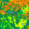
r.sample.category
r.sample.category is a GRASS GIS addon for creating sampling points from each category (class) in a raster map. This is a handy tool for stratified sampling.
-
r.sun.daily
r.sun.daily is a GRASS GIS addon for computing solar radiation for a sequence of days during a year.
-
r.sun.hourly
r.sun.hourly is a GRASS GIS addon for computing solar radiation during a day.
-
g.proj.all
g.proj.all is a GRASS GIS addon to reproject multiple raster or vector maps from one GRASS GIS Location (and CRS) to another.
-
g.rename.many
g.rename.many is a GRASS GIS addon to rename multiple raster or vector maps based on a CSV file which is useful for example, when creating a localized dataset (or an English dataset from a localized version).
Source code repositories
-
GRASS GIS repository
A lot of my code goes directly to GRASS GIS, specifically to its Subversion (SVN) repository which is available online through GRASS GIS Trac or SVN HTML browser.
-
GRASS GIS Addons repository
I try to create most of tools as GRASS modules which we publish in GRASS Addons repository. GRASS Addons Subversion (SVN) repository is available online in the same way as GRASS GIS code itself through GRASS GIS Trac or SVN HTML browser.
-

NCSU GeoForAll Lab organization at GitHub
GitHub is a repository hosting service which works with Git repositories. I have there usually smaller projects or projects in early stages of development which cannot be placed to more appropriate repositories (such as GRASS GIS SVN). Besides my repositories, I also put a lot of code to NCSU GeoForAll Lab repositories.
Statistics
-

Open HUB
Statistics for projects I contribute to which are larger and registered at Black Duck Open Hub, formerly Ohloh (this does not include a lot of medium sized and small projects).

Check also full statistics about my contributions to bigger open souce projects at Black Duck Open HUB.
-

GitHub
Statistics for projects I contribute to through GitHub (i.e. it does not cover all projects, for example GRASS GIS).
wenzeslaus
, , ,
Software I'm using
-

QGIS
QGIS is a free and open source GIS which is easy to use and enables sophisticated cartographic outputs. QGIS is fully-fledged alternative to proprietary tools in terms of functionality, user interface and commercial support.
-

Leaflet
Leaflet is an open source JavaScript library for interactive online maps. It is easy to use, fast and extensible by plugins.